2024-09-25 21:05:03
Helene intensified from a tropical storm to a hurricane on Wednesday morning and is forecast to strike Florida’s Gulf Coast later this week as a major hurricane.
Helene reached hurricane strength while located about 85 miles north-northeast of Cozumel, Mexico and 500 miles south-southwest of Tampa, Florida. As of 11 a.m. EDT, it had maximum sustained winds of 80 mph and was moving northwest at 10 mph, according to the National Hurricane Center.
The storm is expected to grow and strengthen, fueled by record-warm water in the Gulf of Mexico, and accelerate toward the eastern Gulf on Wednesday.
It is forecast to bring “life-threatening storm surge, damaging winds and flooding rain to a large portion of Florida,” the National Hurricane Center warned.
Hurricane warnings are in effect between the Anaclote River and Mexico Beach, Florida. Warnings have also been issued for parts of Mexico. Storm surge warnings have been issued for parts of Florida, including Tampa Bay. Hurricane watches are in effect for Cuba and parts of Florida, and tropical storm warnings and watches also remain in effect for parts of Florida, Cuba and Mexico.
A map from the National Hurricane Center shows Hurricane Helene blowing north through the Florida Panhandle on Thursday night. Tallahassee is in the center of the forecast path.
NOAA/National Weather Service
Remainders of the storm are forecast to pass through Alabama and Georgia on Friday morning, passing over Huntsville and Atlanta, before continuing north through Tennessee and into the Midwest through the weekend.
Strong winds are forecast to hit the Florida Panhandle on Thursday morning, with the storm expected to weaken as it heads into Georgia throughout the day. Parts of the Southeast, including the Carolinas, could still see tropical storm-force winds as the system continues moving inland, however.
NOAA / National Weather Service
Many areas are forecast to see dangerous storm surges, especially between Panama City and Tampa. The coast stretching from the Ochlockonee River to Chassahowitzka could see a surge between 10 and 15 feet. Nearby areas could see between 5 and 10 feet of surge, and the Tampa Bay area is forecast to experience between 5 and 8 feet of storm surge.
The Florida Keys may see between 1 and 3 feet of storm surge.
NOAA / National Weather Service
The Florida Division of Emergency Management’s Know Your Zone map allows residents to input their address and learn their evacuation route in case of flooding or other disaster.
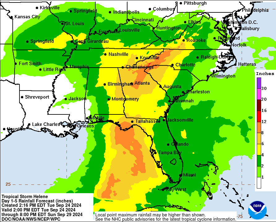
Much of Florida is expected to see one or two inches of rain, but the areas along the coast may see more, according to the hurricane center. Parts of the panhandle and southern Georgia and Alabama may see 4 to 6 inches of rain, and the area around Tallahassee may see up to 8 inches of rain.
NOAA / National Weather Service
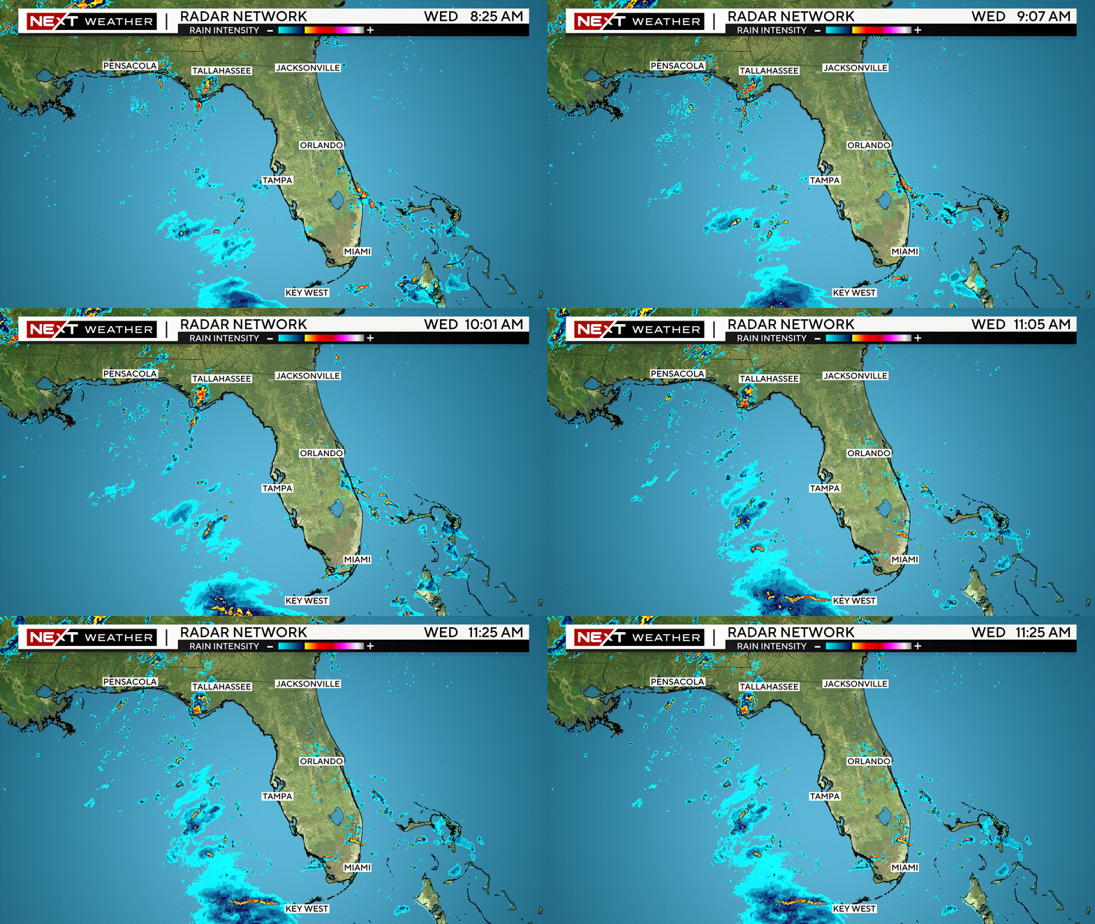
Gusty squalls will sweep across Florida through Wednesday and Thursday, potentially bringing with them heavy rain, strong winds and a brief tornado, according to CBS Miami.
Live radar map
CBS Miami’s live radar map shows the current location and rainfall impacts of Hurricane Helene.


