2024-09-24 07:50:04
Sign up for the Morning Brief email newsletter to get weekday updates from The Weather Channel and our meteorologists.
Potential Tropical Cyclone Nine is expected to organize and be a hurricane threat to the U.S. Gulf Coast later this week.
You can track the storm with the maps below. For the full forecast details, please read our latest article here.
Forecast Path
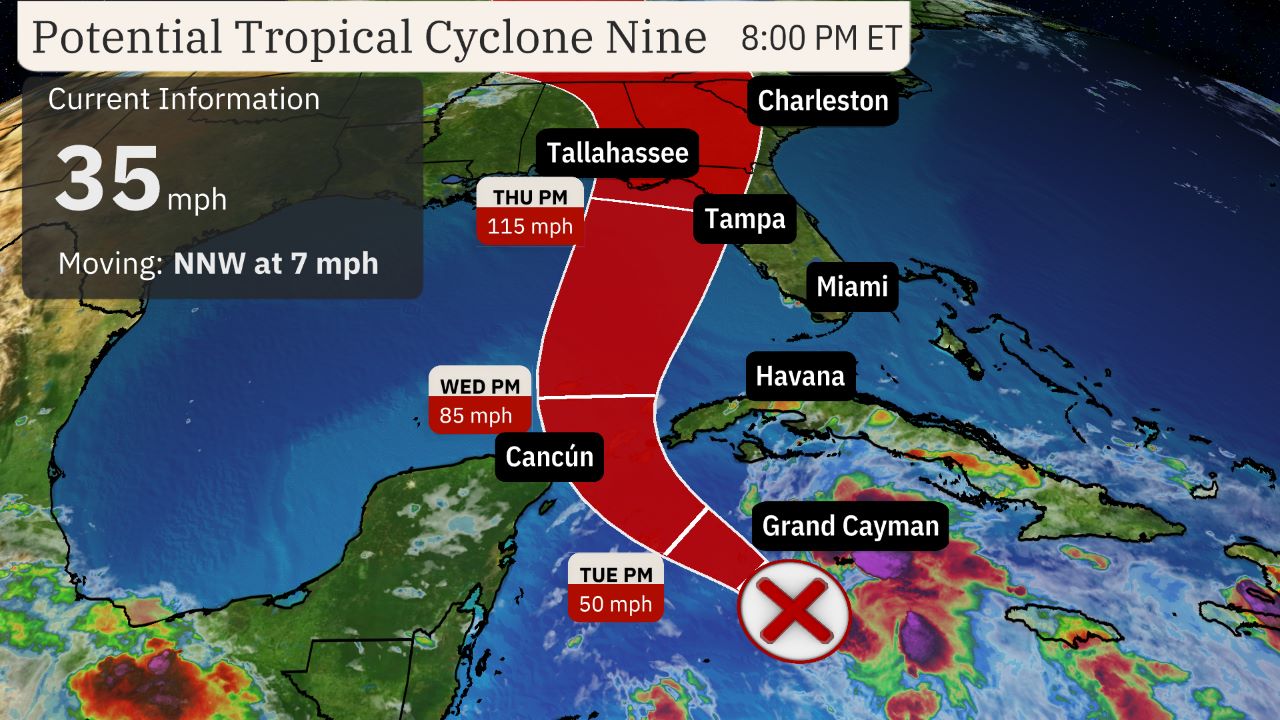

(The red-shaded area denotes the potential path of the center of the tropical cyclone. It’s important to note that impacts (particularly heavy rain, high surf, coastal flooding, winds) with any tropical cyclone usually spread beyond its forecast path.)
Spaghetti Models
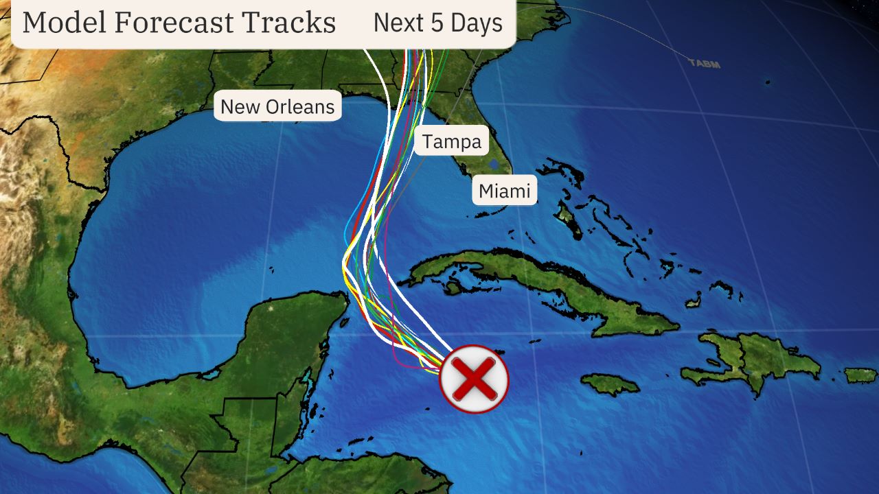

(The lines on this graphic represent several of the many track forecasts from various computer models. This is not an official forecast, but these are used as guidance for creating the projected path.)
Watches And Warnings
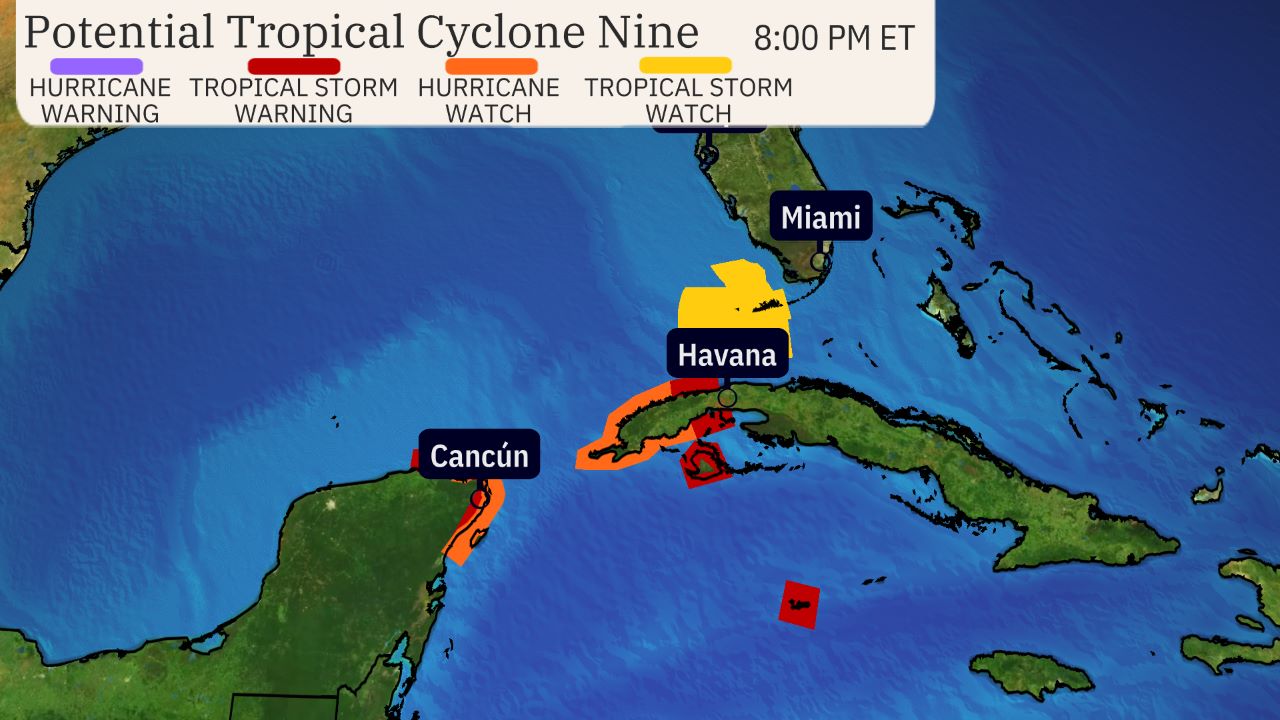

(A watch is issued when tropical storm conditions are possible within 48 hours. A warning is issued when those conditions are expected within 36 hours.)
Current Satellite
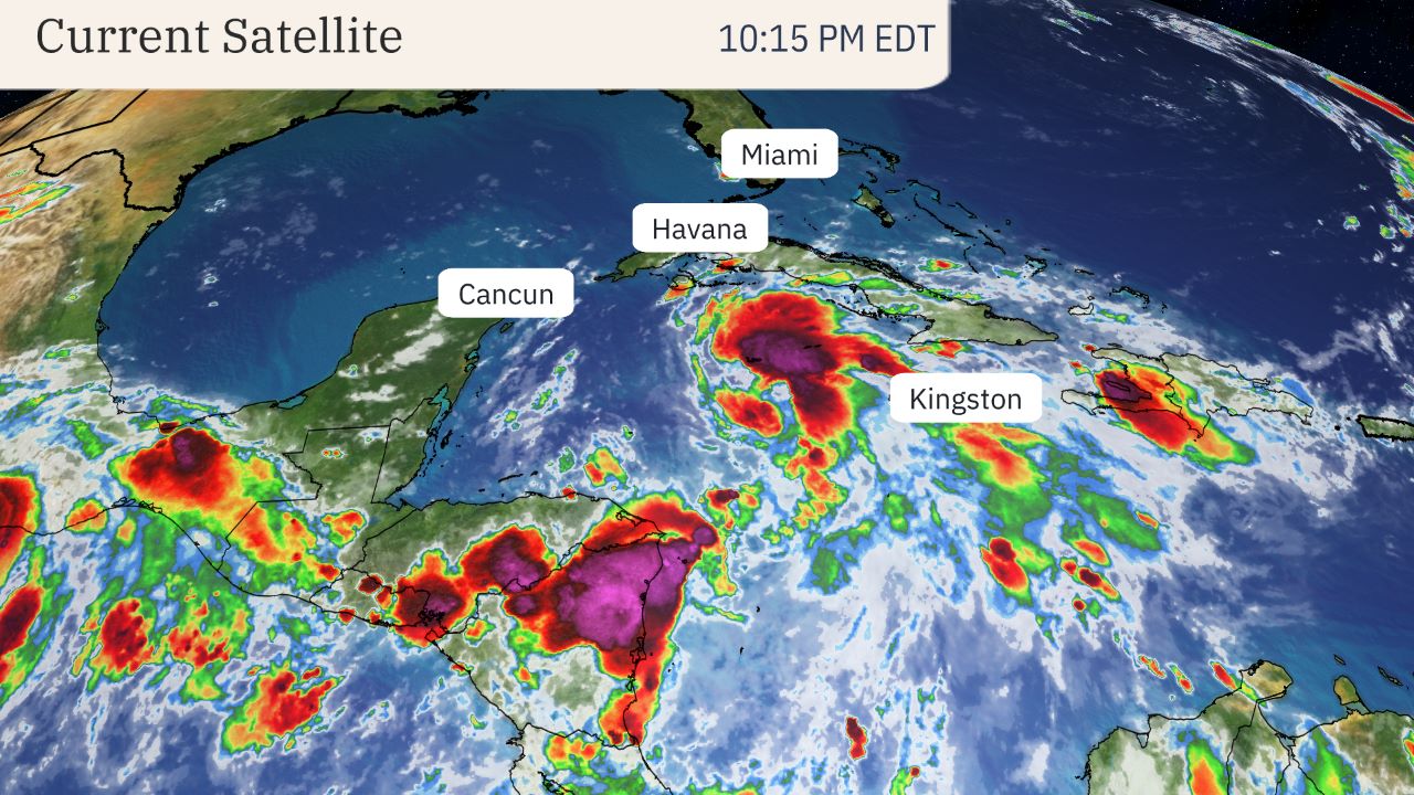

(The highest cloud tops, corresponding to the most vigorous convection, are shown in the dark red and pink colors. Clustering, deep convection around the center is a sign of a healthy tropical cyclone.)
Rainfall Forecast
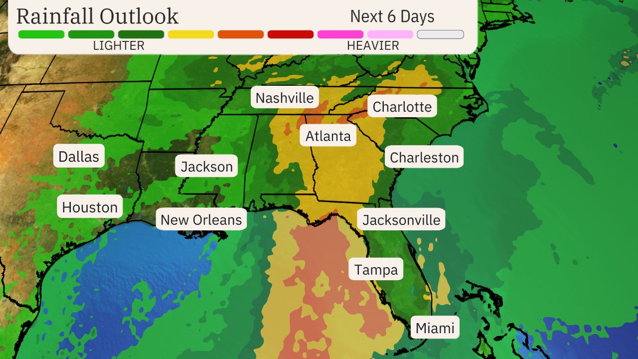

(This should be interpreted as a broad outlook of where the heaviest rain may fall. Higher amounts may occur where bands or clusters of thunderstorms stall for over a period of a few hours.)
Tropical Storm Force Wind Probabilities And Most Likely Arrival Times
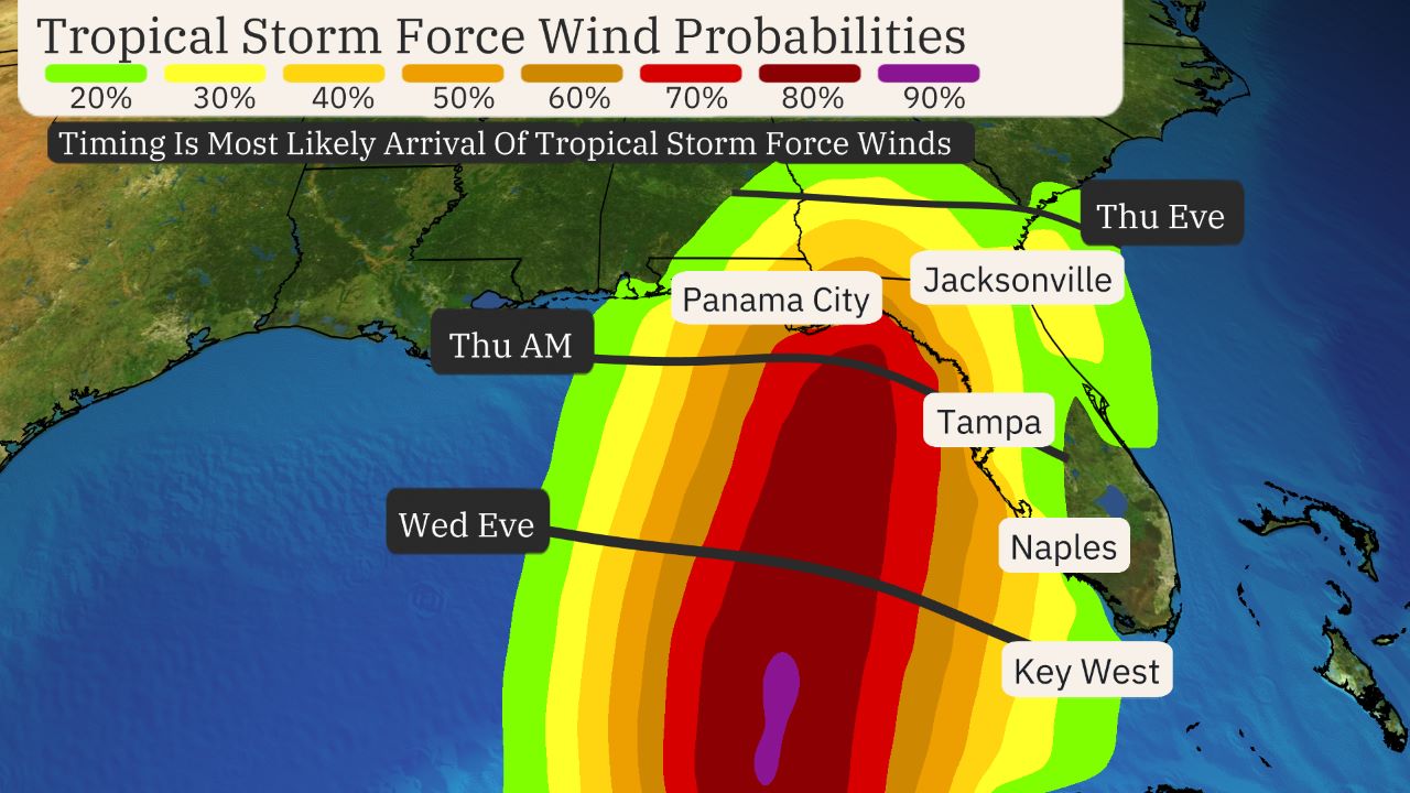

(This map illustrates the timing and potential aerial extent of tropical storm force winds. While some areas may experience hurricane-force winds, the onset of tropical storm-force winds will make storm preparations more difficult. )
Current Wind Shear
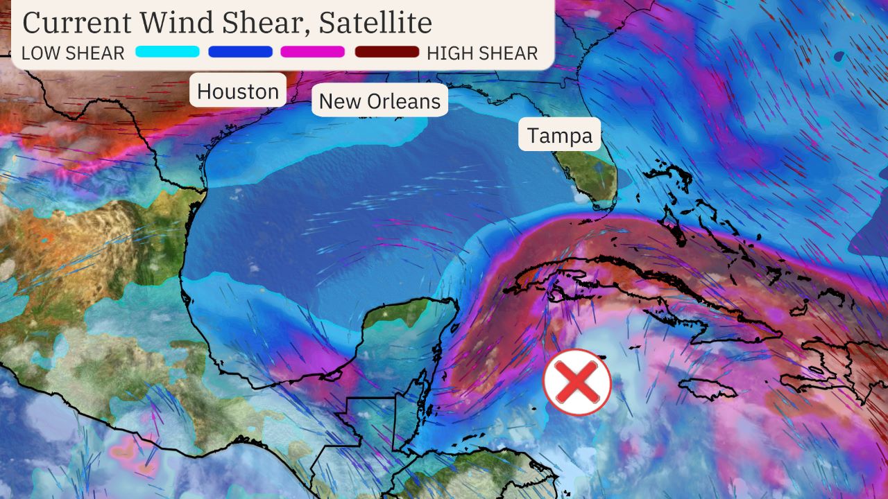

(Areas of clouds are shown in white. Areas of strong wind shear, the difference in wind speed and direction with height, are shown in purple. High wind shear is hostile to mature tropical cyclones and those trying to develop.)
Ocean Heat Content
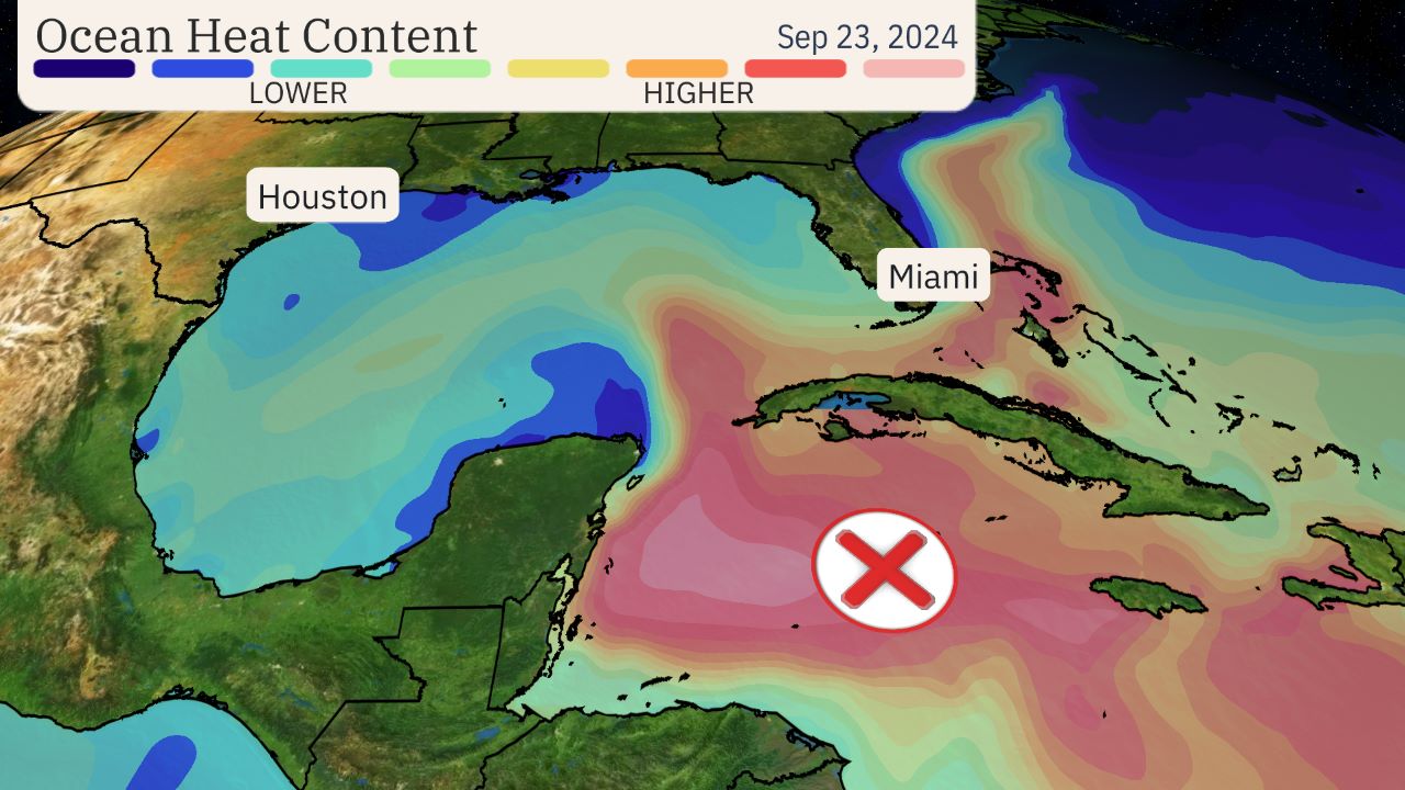

(This map shows areas of not only warm water, but warm, deep water that is one ingredient to fuel developing and active tropical cyclones.)
Linda Lam is a lead meteorologist at weather.com. Growing up in Massachusetts she developed a fascination for winter storms and hurricanes that led her to pursue a career in meteorology.


