
2024-08-03 02:50:02


- Tropical storm watches and warnings have been issued for parts of Florida.
- It’s for a disturbance located near Cuba that is likely to organize into a tropical depression or storm.
- That could happen by this weekend in the eastern Gulf of Mexico, or near Florida.
- Florida and the Southeast coast will see soaking rain from this system.
- Gusty winds and some coastal flooding are also possible impacts.
Tropical storm warnings and watches have been expanded on Florida’s West Coast ahead of a disturbance that could form into Tropical Storm Debby this weekend.
Soaking rainfall, gusty winds and some coastal flooding from this system will likely spread toward Florida over the weekend, and then along the Southeast coast early next week.
(MAPS: Spaghetti Models And More)
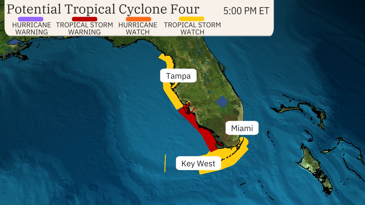
Here’s where tropical storm alerts are in effect: A tropical storm warning has been posted in Florida from East Cape Sable to Boca Grande. Tropical storm watches are in effect for parts of the Florida Keys as well as the southern tip of Florida and west-central Florida from north of Bonita Beach to the mouth of the Suwannee River.
The warning means tropical storm conditions (39- to 73-mph sustained winds) are expected within 36 hours. The watch means tropical storm conditions are possible within 48 hours.
A storm surge watch has also been issued for the west coast of the Florida peninsula from Bonita Beach to the mouth of the Suwannee River, including Tampa Bay and Charlotte Harbor. Life-threatening storm surge is possible in this area.

Here’s where the disturbance is now, as well as its track and intensity forecast: The system is currently located over Cuba and traveling west-northwestward along the country’s spine.
This system is designated as Potential Tropical Cyclone Four. This is a process that allows the National Hurricane Center (NHC) to issue advisories, including watches and warnings and a forecast path, for systems that have yet to develop but are expected to impact land areas within 48 hours.
The latest NHC forecast shows this system becoming Tropical Depression Four by sometime Saturday morning and then Tropical Storm Debby prior to landfall in Florida on Sunday or Sunday night. From there, it’s forecast to track near the Southeast coast early next week, where it could intensify again assuming it remains over water.
There is a possibility this system might slow down or even stall somewhere near the Southeast coast, which could prolong impacts.
(Further beef up your forecast with our detailed, hour-by-hour breakdown for the next 8 days – only available on our Premium Pro experience.)
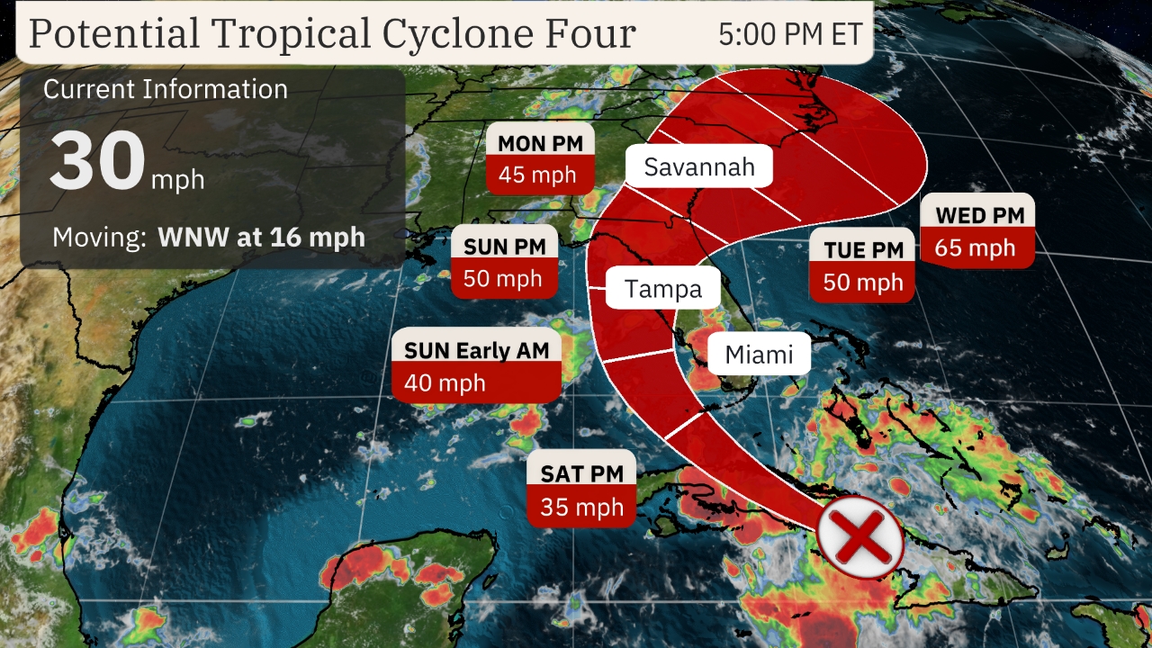

Projected Path
(The red-shaded area denotes the potential path of the center of the system. It’s important to note that impacts (particularly heavy rain, high surf, coastal flooding, winds) with any tropical cyclone usually spread beyond its forecast path.)
Breaking Down The Impacts
Flooding Rainfall
The system is likely to bring rainfall to Florida this weekend. Heavy rain could linger in Florida early next week while also spreading up parts of the Georgia and Carolina coasts. That means flash flooding and isolated river flooding are possible in all of those areas.
If this system slows down or stalls, it could prolong impacts near the Southeast coast and somewhat inland – particularly heavy rain. The slower a tropical system moves, the greater the rainfall. A study released last year by the NHC found rainfall flooding was responsible for the most direct U.S. deaths from tropical storms and hurricanes since 2013.
Rainfall totals of 4 to 8 inches (locally up 12 inches) are possible in spots across Florida and along the Southeast coast through Wednesday morning, the NHC says.
(For even more granular weather data tracking in your area, view your 15-minute details forecast in our Premium Pro experience.)
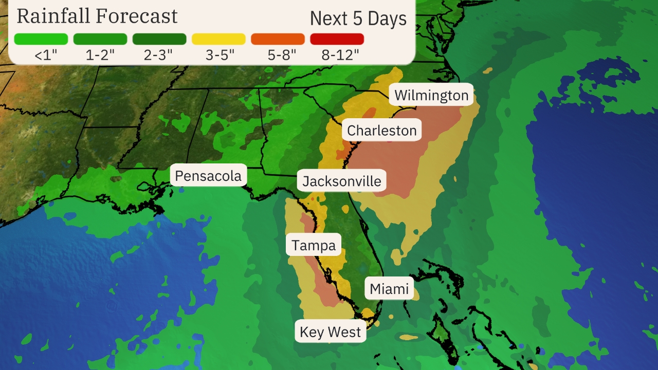

Rainfall Outlook
(This should be interpreted as a broad outlook of where the heaviest rain may fall. It could shift in future updates depending on how well organized this system becomes as well as its future track.)
Storm Surge
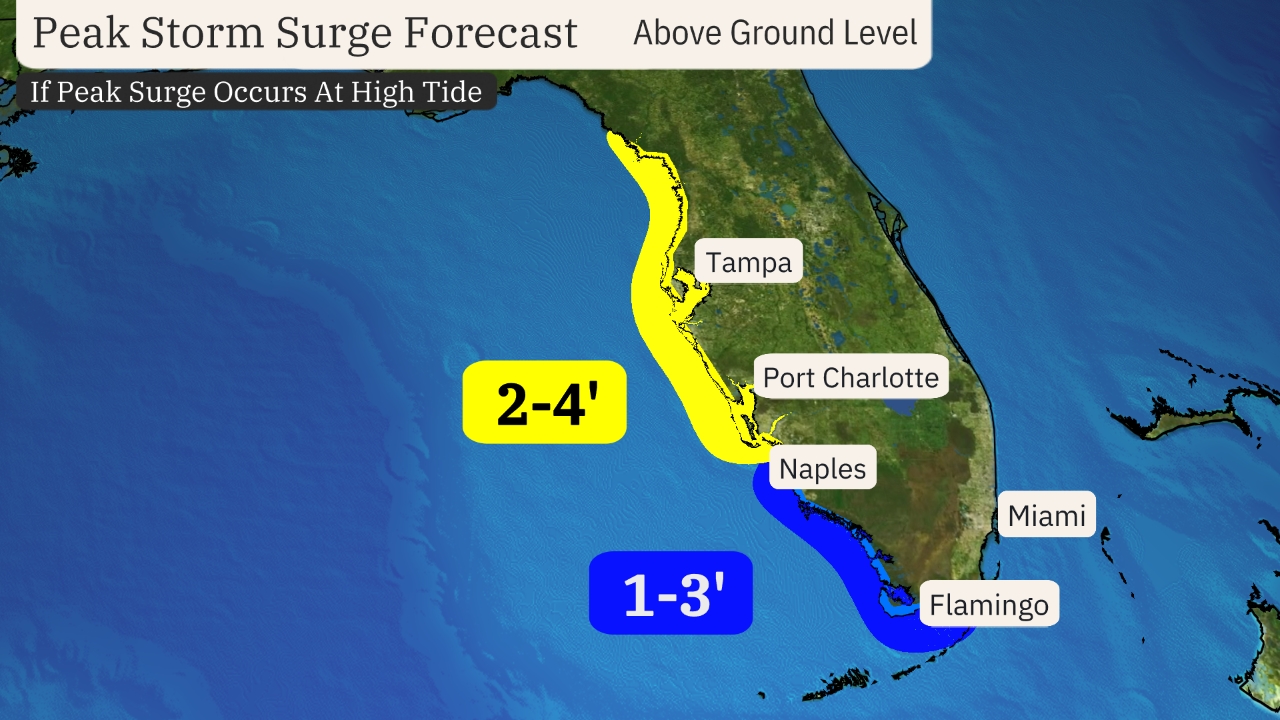
Coastal flooding from storm surge is possible on the western coast of Florida this weekend.
The surge could reach 2 to 4 feet above normal tide levels if the peak surge arrives at high tide, from Bonita Beach to the Suwannee River, including Tampa Bay and Charlotte Harbor.
Eventually, coastal flooding could affect the Southeast coast early next week, but it’s too early for details.

Wind
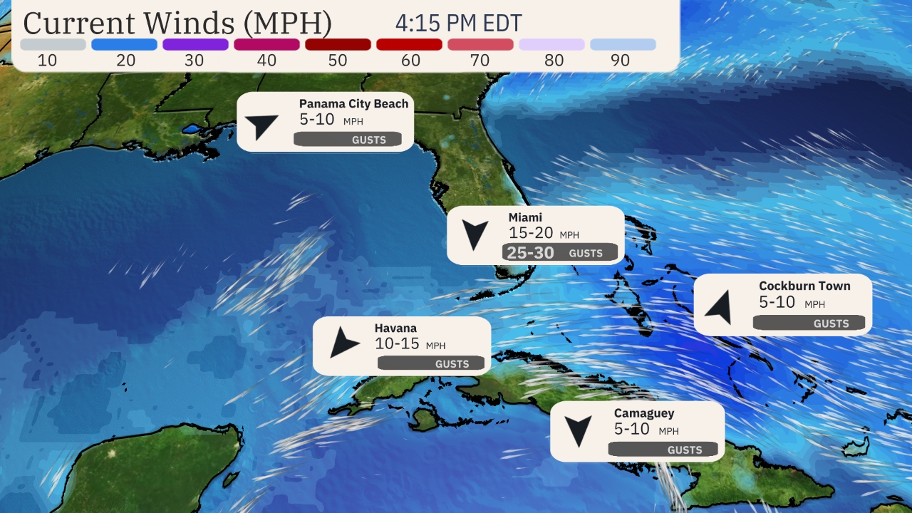
Much of the Florida Peninsula will see gusty winds at times this weekend, especially in heavier bands of rain.
Stronger wind gusts might cause some sporadic power outages or break tree limbs, especially near and inland from where the eventual center of the system tracks.
The Southeast coast is likely to be affected by strong winds early next week.
Be sure to check back frequently to weather.com and The Weather Channel app for forecast updates in the days ahead.

MORE ON WEATHER.COM:
- Hurricane Season Peak Time Begins In August


