
2024-08-02 11:40:02


- A disturbance located in the northern Caribbean islands is likely to organize into a tropical depression or storm.
- That could happen by this weekend or early next week in the eastern Gulf or near Florida.
- Florida will likely see an increase in rainfall this weekend into early next week, regardless of development.
- It’s uncertain what other impacts this system might bring to Florida or other parts of the southern U.S.
A disturbance tracking through the northern Caribbean islands could form into Tropical Storm Debby as it crawls near the eastern Gulf of Mexico and Florida this weekend into early next week. Florida is likely to see locally heavy rain, regardless of how much it develops in the coming days.
Where is the disturbance now? The tropical wave that may eventually become a tropical depression or storm is located near Hispaniola, or near the “X” in the graphic below, according to the National Hurricane Center (NHC).
It’s been called “Invest 97L”, a term used by the NHC to identify features they are monitoring for potential future development into a tropical depression or storm.
When and where could it develop? The NHC says development is now likely by this weekend or early next week, generally in the shaded area on the map below from the eastern Gulf to near Florida. The next storm in the Atlantic will be named Debby.
(For even more granular weather data tracking in your area, view your 15-minute details forecast in our Premium Pro experience.)
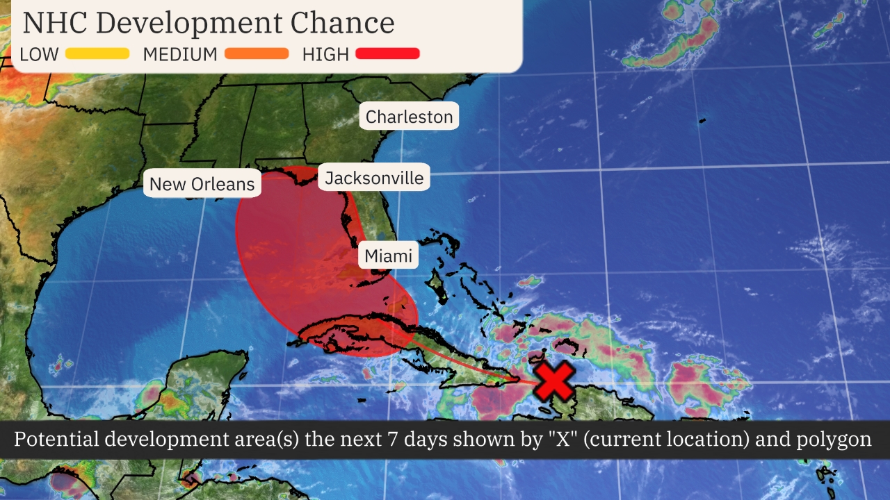

Possible NHC Development
(The possible area(s) of tropical development according to the latest National Hurricane Center outlook are shown by polygons, color-coded by the chance of development over the next seven days. An “X” indicates the location of a current disturbance.)
How favorable is the environment for development? This rather large tropical disturbance will have to interact with land along the way, particularly Hispaniola and Cuba, but also possibly Florida. So, it may take some time for one area of thunderstorms to persist over water, lower surface pressure and begin the process of developing a tropical depression, if that happens at all.
However, computer models suggest wind shear may be relatively light, and there’s plenty of warm ocean water ahead of this system to fuel its development near the Bahamas or the Gulf of Mexico. These are both ingredients favorable for development.
(Further beef up your forecast with our detailed, hour-by-hour breakdown for the next 8 days – only available on our Premium Pro experience.)
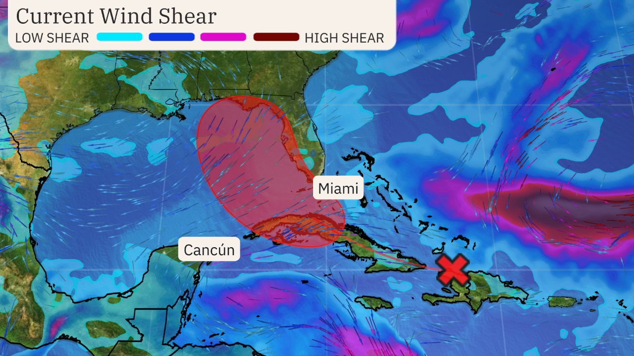

Wind Shear Analysis
(Areas of clouds are shown in white. Areas of strong wind shear, the difference in wind speed and direction with height, are shown in purple. High wind shear is hostile to mature tropical cyclones and those trying to develop. The disturbance location and possible area of development is also plotted, as in the previous map.
)
What is the U.S. threat? Over the past day or so, we’ve seen forecast model guidance trend the development area for Invest 97L westward toward the area between the eastern Gulf of Mexico and Florida.
But that doesn’t necessarily take the Southeast coast out of play. This system could very well end up tracking over the Southeast, even if it trudges into the Gulf Coast first.
There are still a wide variety of scenarios in this uncertain forecast, with tracks ranging from the northern Gulf Coast to the Southeast coast and intensities ranging from an undeveloped low or tropical depression to a hurricane.
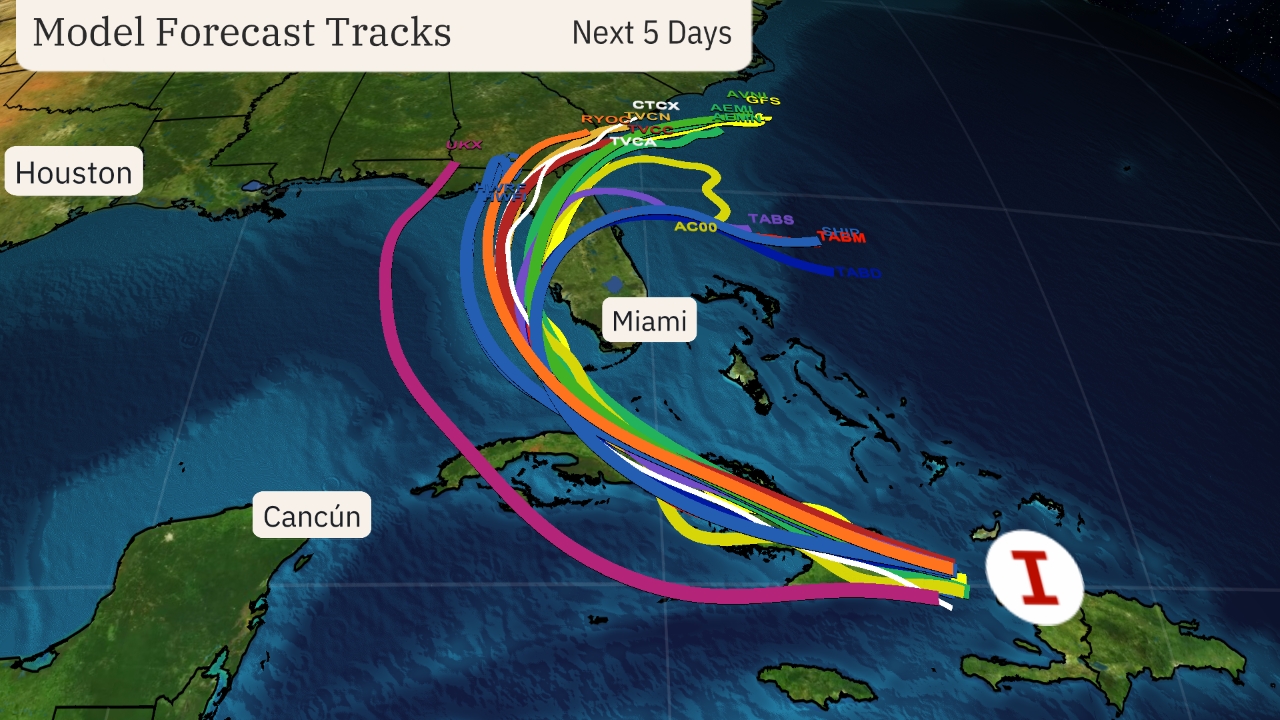

Model Forecast Tracks
(The lines on this graphic represent several of the many track forecasts from various computer models. This is not an official forecast, but these are used as guidance for creating the projected path.)
It could slow down or stall. This system’s forward speed could also come to at least a temporary crawl or move erratically next week if it develops. Essentially, it could get stuck in weak steering winds between two bubbles of high pressure aloft.
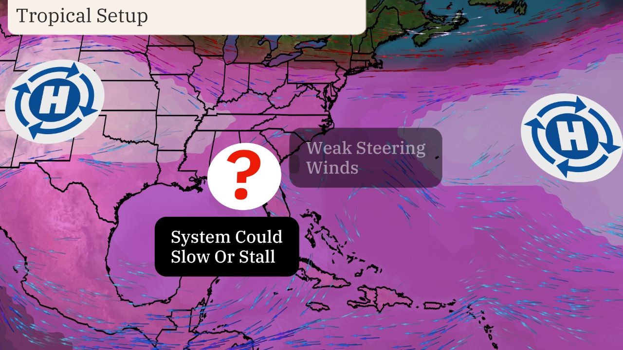

That could prolong impacts, both near the coast and somewhat inland, particularly heavy rain. The slower a tropical system moves, the much greater the rainfall. A study released last year by the NHC found rainfall flooding was responsible for the most direct U.S. deaths from tropical storms and hurricanes since 2013.
The system is likely to enhance rainfall in Florida as soon as this weekend, and probably into at least early next week.
The potential rainfall outlook shown below will likely change in future updates depending on the unknown details of this system.
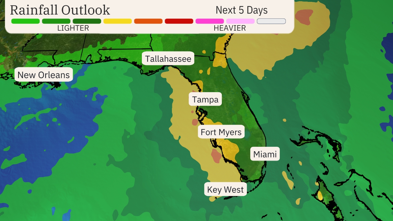

Rainfall Outlook
(This should be interpreted as a broad outlook of where the heaviest rain may fall. It could shift in future updates depending on how well organized this system becomes as well as its future track.)
For now, be sure to check back frequently to weather.com and The Weather Channel app for forecast updates in the days ahead.
MORE ON WEATHER.COM
- Hurricane Season Peak Time Begins In August


