
Kashmir was once known for its spirituality — and not for Pakistani militants and infiltrators as in the 90s. It was fertile ground for spiritual movements, be it the Buddhist, Shaivite and Sufi Islamic traditions, during the medieval ages. They knitted the secular culture called Kashmiriyat that preached brotherhood and peace, and which was lost after Partition.
So, when the army in northern Kashmir opened a few border towns close to the Line of Control to tourists last year, I made plans to visit. Before these hidden gems are invaded by the curious. From among the many — Machil and Tangdhar, to Teetwal, Tulail, Uri and more — I picked Keran and Gurez: north-west and north-east respectively from Baramulla, the big city near the border with Pakistan Occupied Kashmir.
Enroute to Gurez
Gurez
116 km from Baramulla
The trip to Gurez is through mountains fragrant with pine. Some of the trees have strangely curved trunks, pointing to their tenacity to cling to the steep and treacherous sides of the gold streaked rock — reminiscent of the mountainsides in Ladakh. The three-and-a-half hour journey from Bandipora takes us through Sopore, a town that was once a hotbed of militant activity, but is now peaceful, alongside the Wular Lake, and over the rugged peaks of the Pir Panjal range.
The most famous story of Gurez is the love affair between Yusuf Chak, the Shia Muslim king of Kashmir who lived in the 16th century, and the poetess Habba Khatoon, who hailed from the village. The tale goes that he heard her singing in the wilderness, fell in love and married her. She remained queen of Kashmir till her husband was imprisoned by Mughal emperor Akbar, in his bid to conquer Kashmir. One of the peaks here and a hot water spring are named after her. The Dard tribe of Shia Muslims, who are native to Gurez, are now fighting to preserve their language and culture from assimilation and urbanisation.
Security is tight here. Every now and then, an army truck passes us. There are several army camps; the one in Tragbal issues passes to enter Gurez. Then, you turn a bend and Razdan Pass opens out on to jewel-green hillsides. Several bakarwals (a nomadic tribe) cross the peaks looking for pasture for their flocks of sheep and herds of cattle, occasionally causing a traffic jam on the narrow mountain road. A sudden mist envelops us; it descends like a cloud and we stop to take photos.
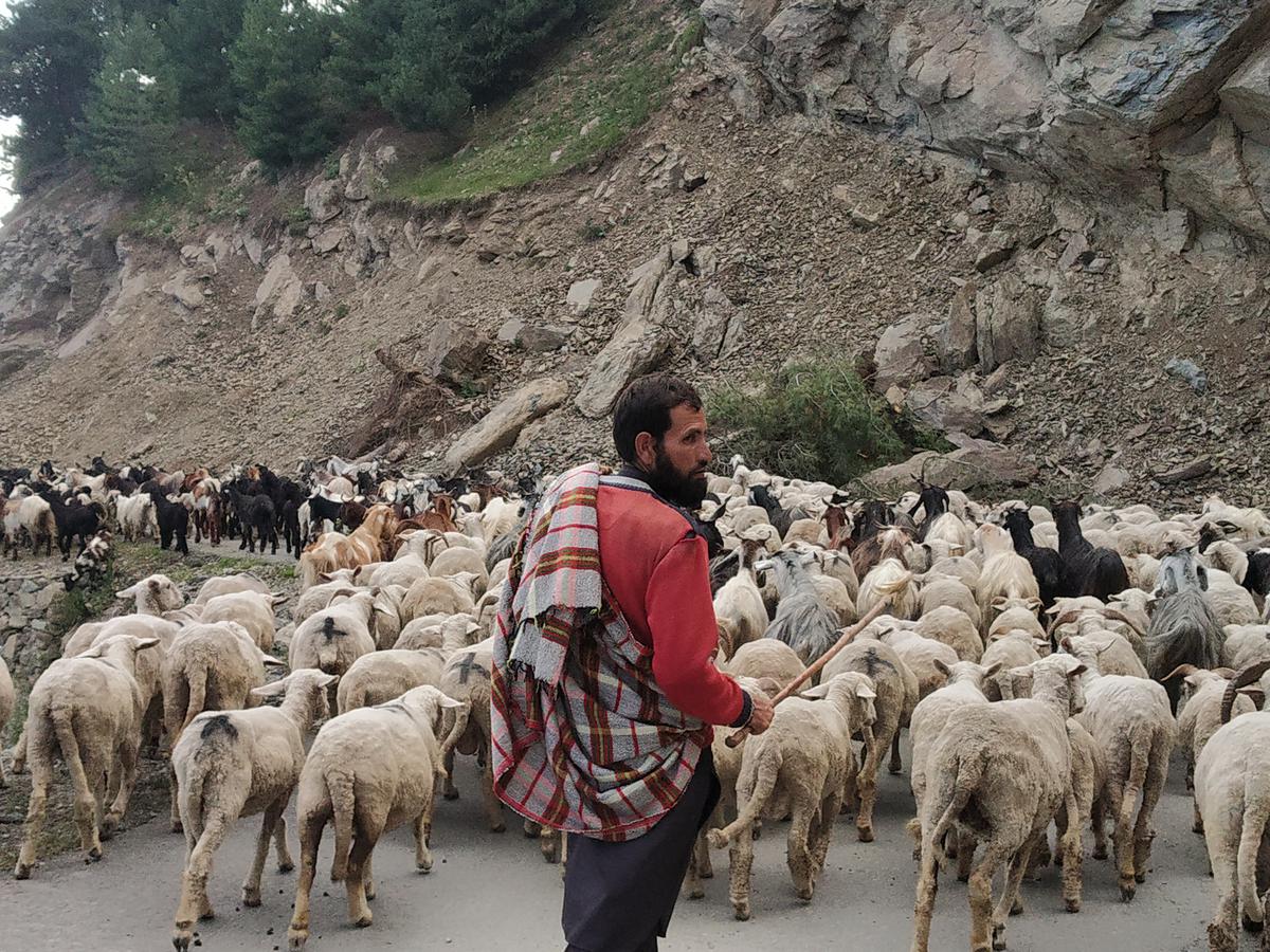
A bakarwal with his sheep
Before we reach Gurez, we encounter the gushing Kishanganga, a tributary of the Jhelum river that is dammed outside the village. It is a unique, cloudy blue and is aptly called Neelum across the border, in Pakistan. The sight is stunning, and reminiscent of the fjords and lakes of Switzerland and Scandinavia. We turn a bend in the road and the village of Gurez appears, nestling in a valley between peaks that rise majestically.
Gurez has a history of 2,000 years. It was part of the silk route between Kashmir, China and Central Asia. Today, it is a typical Kashmiri village with wooden houses. The army runs a canteen here where you can pick up burgers, chow mein and a watery cup of cappuccino. You can also ask for the staple Gurezi dish of steaming potatoes dipped in butter, which is delicious.
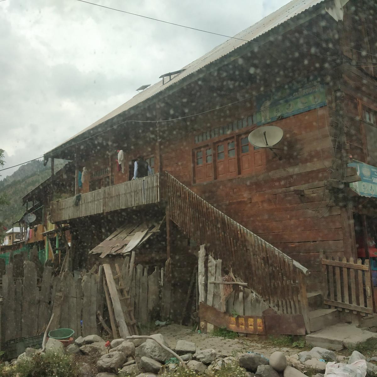
Wooden houses in Gurez
The only other sign of urbanisation is the sign reading ‘I Love Gurez’… possibly an army installation. The bazaar running in the middle of the village sells vegetables, meat and some basic winter wear. Tourists are still rare, which is why there are practically no hotels, but homestays and camps are plenty. Trekkers regularly camp here. I am tempted to sit by the clear river and meditate, but we have time only for a quick lunch and photographs, before we leave for Baramulla. It is dangerous to drive on these mountain roads after dark.
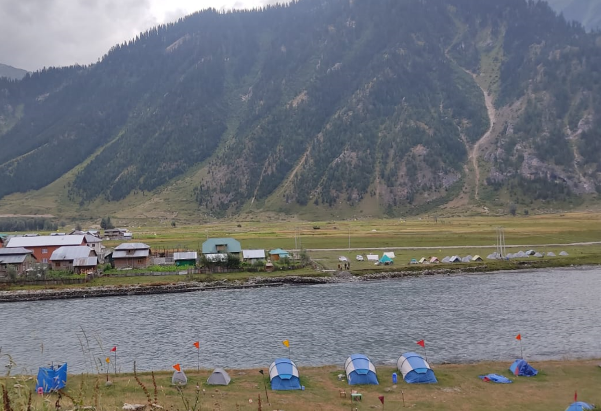
Camping sites are available in Gurez and Keran
Keran
62.9. km from Baramulla
Next, we head to Keran in Kupwara district. The village is surrounded by dense forests, which have been used by militants to infiltrate into India. Security is still a major concern, so the route is through a huge army camp with a helipad, which issues passes to enter the area. As we make our way through, we see a large number of soldiers undergoing combat training. Most are from South India or Rajasthan; there are few Kashmiris in the army.
Said to have been established by Raja Karn in 10th century A.D, Keran was part of the princely state of Jammu and Kashmir. It was divided during Partition, and many of its families were separated; they have not been allowed to meet since by the Pakistani and Indian authorities. The area once had a rich, syncretic culture. Between the 6th and 12th centuries, it boasted the Sharda Peeth temple and university, which was among the most prominent temple universities in India. The ruins lie across the river in Shardi village, in Pakistan Occupied Kashmir. Kashmiri Pandits have been demanding the opening of the Sharda Peeth Corridor for many years now.
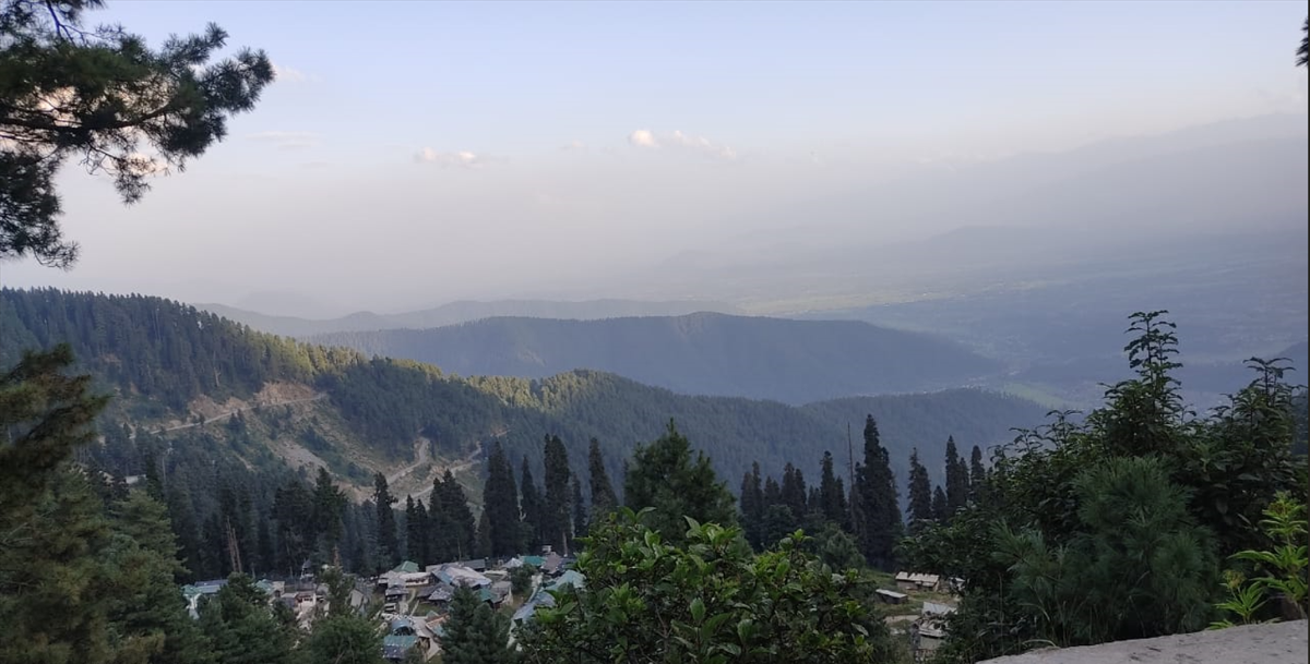
Keran
The route is breathtaking, through thickly forested deodar trees. The road is metalled, but a few kilometres on, it shrivels to a rocky, dusty trail. There is repair work going on. A stream runs alongside, in the gorge.
Keran is an underdeveloped village, which is just waking up to its newly declared status as a tourist spot. There are a few homestays and tourist bungalows; camping is popular here too. Makeshift wooden houses sell Maggie and packaged snacks for the few people who visit, possibly to gawk at the Pakistani side. The curiosity is the same on the other side, which looks far more developed. Sturdy buildings with gaily painted corrugated roofs dot emerald green fields. There is a promenade with a railing and a black signboard that declares it is Kashmir, Pakistan. People walk about, admiring the view and looking into India.
A giant tiranga flutters in lonely splendour on our side. A bunch of schoolgirls in burqas sit chatting under it. I spot an old man looking wistfully at the other side. The lack of building actually gives us an unfettered view of the river and the Pir Panjal peaks — two belonging to India and the third to Pakistan. Plastic chairs are provided for those who want to sit in quiet contemplation.
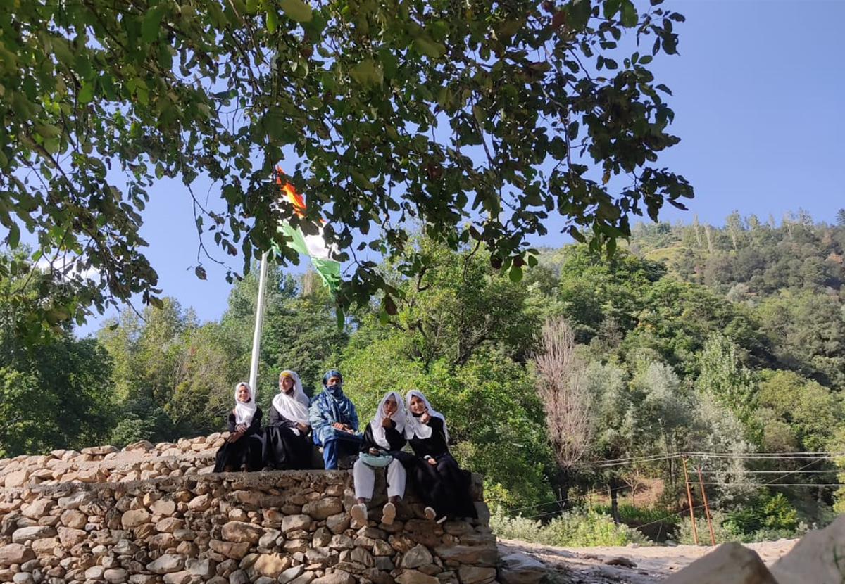
Schoolgirls in burqas under the tiranga
Two Kashmiri boys splash about in the waters where it narrows into a stream. One of them clambers onto a rock and flattens out to sun himself like a tortoise, with the waters raging below. People wash their faces in the stream and drink its water.
After about an hour, we decide to leave. The path back is narrow and the terrain rocky. We fear a puncture, but we reach home safe.
The author is an actor, director and travel writer.


