2024-08-14 00:00:02
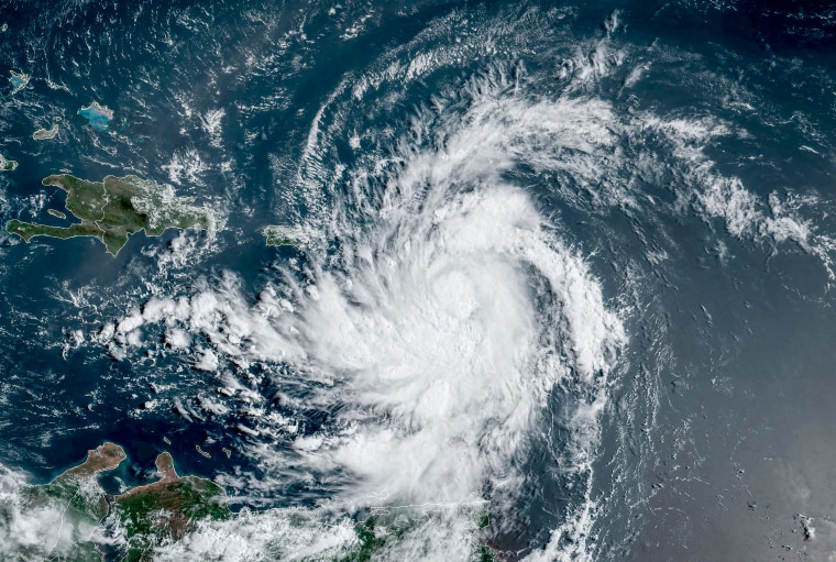
Tropical Storm Ernesto is expected to strengthen into a hurricane in the Atlantic by Thursday, according to the National Hurricane Center.
Ernesto was in the Caribbean on Tuesday morning, about 250 miles east-southeast of San Juan, Puerto Rico, and moving west-northwest at 18 mph with 50 mph maximum sustained winds. That movement is expected to continue through Tuesday night before the storm shifts toward the northwest, then north at a slower speed Wednesday and Thursday.
“On the forecast track, the center of Ernesto should pass near or over the Virgin Islands this evening, and then pass just to the northeast and north of Puerto Rico tonight and on Wednesday,” the hurricane center said Tuesday morning.
The storm will then move across the western Atlantic later in the week.

The storm will continue strengthening over the next few days and is expected to become a hurricane just north of the Greater Antilles — which includes Cuba, Puerto Rico and Jamaica — by Thursday.
Ernesto may bring 4 to 6 inches of rain to parts of the Leeward Islands and Virgin Islands and up to 10 inches of rain across southeastern Puerto Rico, according to the hurricane center.
Water levels may increase by up to 3 feet above ground level on the east coast of Puerto Rico, as well as for the U.S. and British Virgin Islands. Large and destructive waves may accompany the storm surge near the coast of the British Virgin Islands.
Puerto Rico has already activated the National Guard and canceled the start of classes in public schools, The Associated Press reported.
A hurricane watch was issued for the U.S. and British Virgin Islands and Puerto Rico’s Vieques and Culebra. Tropical storm warnings have been issued for Puerto Rico, St. Kitts and Nevis, St. Martin and St. Maarten, Guadeloupe, and St. Barts.


