2024-08-09 11:25:02
Coming off the severe storms on Tuesday, more storms are not ideal. The outer bands of Tropical Depression Debby have made their way into Northeast Ohio this evening.
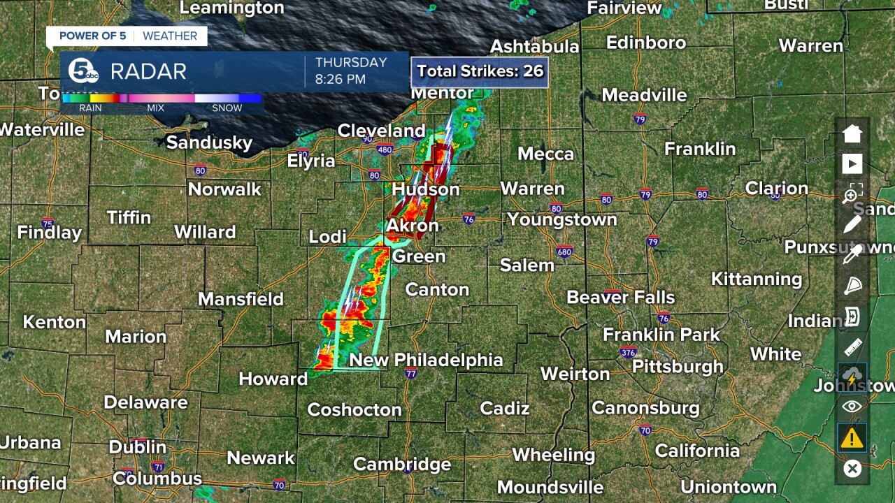
This is a pretty skinny line of storms (only about 10 miles across), but it is dropping buckets of rain across many communities. Not only is the rain rate high, these storms are barely moving resulting in flash flooding this evening. Take these warnings seriously, especially as the sun goes down.
Turn around, and don’t drown when encountering flooded roads. Most flood deaths occur in vehicles, and it can be very difficult to see flooded roads at night.

NEWS 5
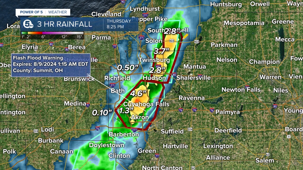
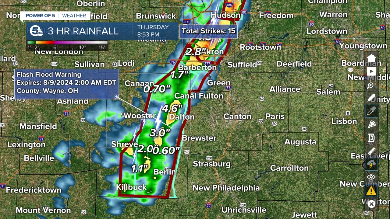
The National Weather Service in Cleveland has issued flash flood warnings for Summit County until 1:15 a.m. Friday. A second flash flood warning has been issued for southwestern Geauga County, northwestern Portage County, and northeastern Summit County until 1:30 am Friday. A third flash flood warning has been issued for eastern Holmes, SE Medina, SW Summit, and eastern Wayne counties until 2:00 am Friday.
Doppler radar indicated thunderstorms producing heavy rain across the warned area. Between 2 and 3.5 inches of rain has already fallen. Additional rainfall amounts of 1 to 2 inches are possible in the area. Flash flooding is ongoing or expected to begin shortly. Flash flooding of small creeks and streams, urban areas, highways, streets, and underpasses, as well as other poor drainage and low-lying areas.
Some locations that will experience flash flooding include Akron, Cuyahoga Falls, Barberton, Hudson, Tallmadge, Streetsboro, Stow, Norton, Fairlawn, Munroe Falls, Silver Lake, Boston Heights, Solon, Hudson, Twinsburg, Streetsboro, South Russell, Aurora, Reminderville, Bainbridge, Wooster, Millersburg, Barberton, Wadsworth, Orrville, Berlin, Rittman, Doylestown, Killbuck, and Holmesville.

NEWS 5

News 5
Want the latest Power of 5 weather team updates wherever you go? Download the News 5 App free now: Apple|Android
Download the StormShield app for weather alerts on your iOS and Android device: Apple|Android
Click here to view our interactive radar.
Read and watch the latest Power of 5 forecast here.
Follow the News 5 Weather Team:
Mark Johnson: Facebook & Twitter
Trent Magill: Facebook & Twitter


